| DAMAGING FLOODS |
| Location | Start Date | Information |
|---|
| Big Horn River, Wind River | 23-Jul-1923 | Widespread thunderstorms caused a 25- to a greater than 100-year flood resulting in $1 million in damage to Chicago and Northwestern Railway. The event took two lives. |
| Hudson, Popo Agie River, Little Popo Agie River | 10-Feb-1962 | Heavy spring runoff, breakup of ice, and ice jamming at old bridge caused major flood damage. Muskrat Creek near Shoshoni had a discharge of 13,300 CFS. |
| Lander, Middle Popo Agie | 15-Jun-1963 | A greater than 500-year flood from a combination of heavy rain (3 inches) and failure to an earthen reservoir caused minor damage to homes, inundated part of the city, resulting in an estimated $90,000 in damage according to city officials. The following are discharge amounts: Middle Popo Agie River below the Sinks, near Lander - 4,180 CFS, North Popo Agie River near Milford - 4,500 CFS, Little Popo Agie River near Lander - 2,010 CFS. |
| Park, Sheridan, Big Horn, Washakie, Hot Springs and Fremont | 15-Jun-1963 | Heavy rains in the Wind River, Absaroka, and Big Horn Mountains caused flash flooding during Saturday and Sunday, the 15th and 16th. Considerable damage done to homes, equipment, crops, irrigation canals, roads and bridges. |
| Fremont | 20-Sep-1963 | Heavy rains in the Crowheart-Dubois area caused flash flooding with considerable damage to roads, bridges, crops and the irrigation system. |
| Crowheart, Dubois | 20-Sep-1963 | Heavy rains caused flooding, resulting in damage to roads, bridges, crops, and irrigation systems |
| Riverton/Lander area | 8-Sep-1973 | Rain and hail from a series of thunderstorms, hail mostly small but some to 1.25 inches, along with high water, caused damage primarily to crops but also to some structures, cars and materials. |
| Hudson | 2-Mar-1974 | A combination of abnormally high temperatures, rain, and strong Chinook-type winds in late February and early March resulted in rapid snow melt and flooding along the Popo Agie River. Hardest hit was the southern portion of Hudson where an ice jam against a highway bridge intensified the flooding and forced nearly 60 families from their homes. Damage was estimated at $500,000.
North and South Forks of Shoshone and Wind Rivers, Shoshone River, and Upper Snake River 7-Jun-1981 Widespread rainfall combined with snowmelt runoff. Damage to rural property. 40- to 100-year flood (Wyoming Floods and Droughts, National Weather Summary 1988-89). Bridges, campgrounds, highways, personal property damaged (WEMA Storm Data). |
| Park and Fremont | 7-Jun-1981 | Heavy rains occurring the week of the 7th through the 12th caused the flooding on the North and South Forks of the Shoshone River and on the Wind River. Many bridges, campgrounds, highways, and pieces of personal property were damaged. |
| Dubois | 24-Jul-1982 | A cloudburst caused Tappon Creek north of Dubois to flood and overflow into Pony and Horse Creeks. Mud and debris covered parts of Highway 287 and caused some damage to two homes in the area. |
| North Portal Area | 27-Jul-1982 | Thunderstorms dumped up to three inches of rain in the North Portal Area of Northern Fremont County during the evening causing flash flooding and road washouts in some places. |
| Fremont, Hot Springs, and Washakie | 10-Aug-1983 | A large area of severe thunderstorms rumbled through west central Wyoming. Three-quarter inch hail fell near Thermopolis and just northwest of Worland, causing extensive crop damage especially to beets. The storms also had very intense and frequent lightning, which caused power outages and damages to homes and barns in the Riverton and Worland areas. Minor flash flooding was also reported near Riverton and Worland as 1 to 2 inches of rain fell. |
| 17 SE Riverton | 29-Jul-1990 | A slow-moving thunderstorm produced over 2 inches of rain about 17 miles southeast of Riverton between 1500 and 2000 MST. Flash flooding occurred along State Highway 135, covering the road to a depth of around 4 feet and washing out two sections of the road. |
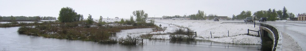
| Riverton | 7-Jun-1991 | Flooding of the Wind River at Riverton resulted in 12 homes being flooded and loss to crops along the river. High water due to past rains and snow melt.. |
| Fremont | 14-Jun-1995 | A prolonged episode of flooding occurred in Fremont County as warm temperatures in the mountains brought a rapid snowmelt. The Big Wind River, the Little Wind River, and the Popo Agie River overflowed their banks and caused considerable flooding. The town of Hudson (10 miles northeast of Lander) had some lowland flooding that did some damage to a few homes. Flooding occurred at the Lander City Park as well as at other locations. Five mobile homes had severe damage due to flood waters. The worst flooding at Riverton occurred on the far south side of town and at the Wind River Indian Reservation. A total of 11 homes were damaged with four of them seriously damaged. Some roads were under water for three or four days and some bridge damage was also reported. About 40 people had to be evacuated in Fremont County due to the flooding. As of August 10th, no damage figures were available. There was one fatality due to the flooding. |
| Crowheart to Riverton, Big Wind River | 14-Jul-1995 | Rain and snowmelt pushed the Big Wind River over flood stage from Crowheart to Riverton. A section of dirt berm gave way in the early morning, allowing water to cross the highways south of Riverton. Trailer homes to the south of Riverton were also flooded. |
| 5 S Riverton | 8-Jun-1997 | Portion of Highway 789 closed due to water and debris over road. Two homes flooded. Water over Highway 134. Basements flooded. |
| 15 N Riverton | 8-Jun-1997 | Portion of Highway 789 closed due to water and debris over road. Two homes flooded. Water over Highway 134. Basements flooded. |
| Dubois | 12-Sep-1998 | Street flooding and some basements flooded in and around Dubois. Intense, slow-moving thunderstorms. |
| Riverton | 12-Sep-1998 | Some streets and sidewalks near downtown under 1 foot of water. Intense, slow-moving thunderstorms. |
| Lander Foothills - Wind River Basin | 19-Jun-1999 | Minor flooding of the Wind River along and near Highway 789 just south of Riverton and Highway 26 northwest of Riverton between Crowheart and Morton. Several homes isolated by floodwaters. |
| Lander | 14-Sep-2001 | One foot of water reported on Main street, between 1st and 9th streets. |
| Lander | 14-Sep-2001 | Nursing home ceiling collapsed due to the weight of accumulated hail and rain. |
| 4 W Shoshoni | 17-Jun-2003 | Water flowing over US Highway 20/26. |
| NON-DAMAGING FLOODS |
| Pavillion | 22-May-1997 | Flash Flood |
| Wind River Basin | 1-Jun-1999 | Minor flooding of the Wind River along Highway 789 just south of Riverton. |
| Lander | 14-Sep-2001 | Flash Flood |
| Lander | 14-Sep-2001 | Flash Flood |
| 10 N Lysite | 16-Jun-2003 | Flash Flood |
| 9 S Moneta | 15-Jul-2004 | Flash Flood |