|
Washakie County Historical Floods
| DAMAGING FLOODS |
| Location | Start Date | Information |
|---|
| Wind River, Absaroka, and Big Horn Mountains | 15-Jun-1963 | Heavy rains in the Wind River, Absaroka, and Big Horn Mountains caused flash flooding during Saturday and Sunday, the 15th and 16th. Considerable damage done to homes, equipment, crops, irrigation canals, roads and bridges. |
| Central and North portions of Wyoming | 15-May-1978 | Heavy wet snow and record rains did very extensive damage to property, crops, and livestock in 12 counties. Hundreds of homes were damaged, and many totally destroyed. Numerous bridges and sections of roads were washed out, power lines downed, with much damage to cars and personal property. Total estimated damages came to $15.5 million. The following are discharge amounts from WEMA Storm Data: Fifteenmile Creek near Worland (May 18) - 4,270 CFS, Big Horn River at Worland (May 19) - 17,500 CFS, Nowood River near Ten Sleep (May 19) - 3,380 CFS, Shoshone River near Lovell (May 18) - 7,680 CFS), Elk Creek near Basin (May 19) - 2,450 CFS, Shell Creek near Greybull (May 19) - 2,150 CFS, Big Horn River near Kane (May 20) - 20,700 CFS, Little Powder River below Corral Creek near Weston (May 18) - 2,410 CFS, Little Powder River above Dry Creek near Weston (May 19) - 4,460 CFS, Little Powder River above Dry Creek near Weston (May 19) - 5,300 CFS, Salt Creek near Sussex (May 18) - 10,200 CFS, Dead Horse Creek near Buffalo (May 18) - 1,420 CFS, Clear Creek below Rock Creek 162? CFS, Powder River near Kaycee (May 18) - 4,200 CFS, Powder River at Sussex (May 19) - 24,000 CFS, South Fork River near Kaycee (May 20) - 8,200 CFS, Bitter Creek near Garland (May 17) - 552 CFS, Whistle Creek near Garland (May 18) - 2,340 CFS, Shoshone River below Buffalo Bill Reservoir (May 19) - 1,230 CFS, Shoshone River near Garland (May 19) - 4,550 CFS, Goose Creek below Sheridan (May 18) - 5,430 CFS, Prairie Dog Creek near Acme (May 19) - 3,940 CFS, Clear Creek at Ucross 1740 (May 19) - 32,500 CFS, Crazy Woman Creek at Upper Station (May 20) - 2,200 CFS, Little Thunder Creek near Hampshire (May 18) - 3,030 CFS, Black Thunder Creek near Hampshire (May 18) - 5,050 CFS, Turner Creek near Osage (May 18) - 2,480 CFS, Beaver Creek near Newcastle (May 19) - 3,870 CFS. The event was estimated to be a 20- to greater than 100-year flood |
| 4 miles Northwest Worland | 22-Jul-1979 | Thunderstorms caused a flash flood 4 miles northwest of Worland, damaging their water supply canal ($50,000 est.). High winds with this storm also caused another $20,000 damage to several farm shops and a grain bin. |
| Worland | 9-Aug-1982 | High wind associated with localized heavy rain and hail blew over an empty pup trailer on a Pepsi semi rig about 4 miles south of Worland causing $3000 damage. Local urban flooding was reported 6 miles south of the city. |
| Washakie Conservation District, Little Gooseberry | 10-Aug-1983 | State Highway, Burlington Northern railroad tracks, the Bluff Canal; amount of damage $38,500 |
| Fremont, Hot Springs, and Washakie | 10-Aug-1983 | A large area of severe thunderstorms rumbled through west central Wyoming. Three-quarter inch hail fell near Thermopolis and just northwest of Worland, causing extensive crop damage especially to beets. The storms also had very intense and frequent lightning, which caused power outages and damages to homes and barns in the Riverton and Worland areas. Minor flash flooding was also reported near Riverton and Worland as 1 to 2 inches of rain fell. |
| Worland (10N) | 7-Jun-1987 | A thunderstorm swept through northern Washakie County north of Worland with drenching rain. A pipeline plant, 7 houses and numerous crop fields north of Worland were flooded by the rain. The pipeline plant reported 4 foot deep flood waters. A farmer, located north of Worland, said 100 acres of barley and hay were under water, |
| Worland (10N) | 8-Jun-1987 | A torrential rainstorm moved west and north of downtown Worland. This rain storm dumped between 1 to 4 inches of rain over the Worland area in a couple of hours. The sheriff's department reported numerous fields of crops damaged, with a few roads flooded, mainly west and north of Worland. One farmer lost nearly 200 acres of malt barley, alfalfa, and sugar beets. Heavy rain on June 7 and 8 north of Worland helped wash out a good section of an irrigation canal on the night of June 8. Extensive flooding was also noted by the sheriff's department along the Washakie and Big Horn county line later that night. |
| Park, Big Horn, and Washakie | 7-May-1988 | The winter-like storm system of the 6th and 7th produced heavy snowfall above 6000 feet and drenching rainfall below. Between 1.5 and 5.0 inches of rain fell in less than 24 hours. This damaged the newly planted crops of beets and barley to extent that 500 acres of beets will have to be replanted. Estimated damage from flooded houses, washed out bridges, damaged culverts and canals, damaged roads, and other damage to irrigation works and utility lines ranged from $500,000 to more than $1 million. Rainfall amounts in less than 24 hours included 1.73 inches at Lovell, while Cowley, Deaver, and Frannie received 2.40, 1.60, and 3.30 inches of rain, respectively. Most of the flood damage occurred in Park County, which was later declared a disaster area. At least 17 bridges or crossings were destroyed and 6 roads washed away by the flood waters in Park County. |
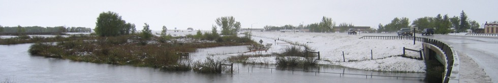
| North Big Horn Basin, South Big Horn Basin | 29-Jan-1996 | Warmer temperatures caused minor ice jam flooding on the Big Horn River from Worland to Manderson. |
| North Big Horn Basin, South Big Horn Basin | 13-Mar-1996 | Ice jams caused flooding in lowland areas around Greybull on the Big Horn River. Other rivers and streams in the southern part of the Big Horn Basin also had flooding due to ice jams. A one hundred foot long footbridge was washed out between Ten Sleep and Manderson on March 13 on the Lower Nowood River. Flooding also occurred between Manderson and Basin, shortly after midnight on March 13. A factory on the north side of Greybull was flooded. The sewer lagoon for the city was also underwater during this time. |
| 15 SW Worland | 10-Jul-2001 | Flash flooding of many creeks and washes with water across the road near Winchester. |
| NON-DAMAGING FLOODS |
| 12 SSE Ten Sleep | 26-Jul-2003 | Otter Creek exceeded its banks causing water to flow across the yard of one residence. |
|