| DAMAGING FLOODS |
| Location | Start Date | Information |
|---|
| Wheatland, Rock Creek | 16-May-1935 | Heavy rain produced a flood that damaged property, railways, and roadways. The following are discharge amounts: Hartville Canyon - 3,800 CFS, Whalen Canyon - 6,200 CFS, and Cottonwood Canyon - 5,000 CFS |
| Wheatland, Rock Creek | 31-May-1935 | Heavy rain producing a flood killed 8 people and damaged property, roads, and railroads. Estimated damage for three counties of Laramie, Goshen, and Platte was $1,250,000. Discharge of streams was 14,000 CFS. |
| Wheatland, Rock Creek | 29-May-1938 | Property, roadway, and railway damage. Loss of lives. |
| Wheatland, Rock Creek | 9-Jun-1949 | A flood caused property, railway, and roadway damage as well as interruption of transportation. It also caused loss of lives. |
| Platte County | 5-Jul-1962 | Heavy rains and several inches of hail both afternoons caused severe crop damage and flooding of homes and out-buildings in the Wheatland area. |
| Central Wyoming | 13-May-1965 | Heavy rains, especially in the central mountains, on top of the heavy snow of the 8th and 9th caused flash flooding on streams flowing out of the Laramie mountains between Wheatland and Casper. Damage to Bridges, roads, crops and housing was especially heavy from Glendo through Douglas to Glenrock. |
| Glendo | 14-Jun-1965 | Heavy rains in the mountains west of Glendo resulted in flash flooding of farms and ranches along streams, destroyed highway bridges on both sides of Glendo and destroyed a railroad bridge north of Glendo. |
| Wheatland, Wheatland Reservoir 1 | 8-Jul-1969 | Dam break with wall of water 50 feet high damaged crops , livestock killed and families forced to evacuate. Over $1 million worth of damage |
| Southeast Wyoming | 10-Jun-1970 | Heavy rains up to 6 inches in the Laramie Mountains from Casper to Wheatland caused flooding on the tributaries of the North Platte River. Some of the moisture fell as snow above 7500 feet elevation. |
| Wheatland 15 W | 31-Jul-1976 | Heavy rains estimated to 9 inches caused flash flooding in Palmer Canyon. One ranch damaged and several bridges, culverts, and stretches of road were washed away or damaged. |
| Glendo | 11-Aug-1982 | Local rural flooding occurred when 1.5 to 2.5 inches of rain and small amounts of hail fell in less than 1 hour. Considerable damage to fences was reported. |
| Southeast corner | 22-Jul-1984 | Golf ball-sized hail, wind gusts to 80 MPH and very heavy rain hit area a few miles west of Wheatland in Platte County. Couple houses had 4 to 5 feet of water in them. Severe thunderstorm with golf ball-sized hail in Burns and Hillsdale area of east Laramie County did over $500,000 damage to crops, vehicles, and buildings. |
| Wheatland 10W | 7-Jun-1987 | A severe thunderstorm developed over Laramie Peak in the Laramie Mountains after 1815 MST and moved southeast. This severe thunderstorm moved over the town of Wheatland and dumped between 2 to 5 inches of rain over the Wheatland area in a little more than 1 hour. Also. hail between 0.75 and 1.75 inches in diameter accompanied these torrential rains. The heavy rains caused flooding mostly along the North Laramie River and Cottonwood Creek, and some if this flooding extended into the town of Wheatland. Many houses in the west section of Wheatland were flooded with between 4 inches to 4 feet of water. Due to the heavy rain, numerous road closures were reported over central and southern Platte County. There was also a report of extensive crop damage to corn and beans. As the severe thunderstorm continued southeast, two funnel clouds were spawned by the storm. The first funnel cloud was spotted about 20 miles south of Wheatland. The second funnel was located 15 miles west of Veteran, in central Goshen County. Reports from the Emergency Management officials showed that neither of the funnel clouds touched down. This severe thunderstorm also pelted Chugwater with 1.75-inch diameter hail, but no damages were reported. Later, as the storm moved into Laramie County, 0.5-diameter hail fell 6 miles north of Cheyenne.
|
| Wheatland | 7-Jun-1987 | A severe thunderstorm developed over Laramie Peak in the Laramie Mountains after 1815 MST and moved southeast. This severe thunderstorm moved over the town of Wheatland and dumped between 2 to 5 inches of rain over the Wheatland area in a little more than 1 hour. Also. hail between 0.75 and 1.75 inches in diameter accompanied these torrential rains. The heavy rains caused flooding mostly along the North Laramie River and Cottonwood Creek, and some if this flooding extended into the town of Wheatland. Many houses in the west section of Wheatland were flooded with between 4 inches to 4 feet of water. Due to the heavy rain, numerous road closures were reported over central and southern Platte County. There was also a report of extensive crop damage to corn and beans. As the severe thunderstorm continued southeast, two funnel clouds were spawned by the storm. The first funnel cloud was spotted about 20 miles south of Wheatland. The second funnel was located 15 miles west of Veteran, in central Goshen County. Reports from the Emergency Management officials showed that neither of the funnel clouds touched down. This severe thunderstorm also pelted Chugwater with 1.75-inch diameter hail, but no damages were reported. Later, as the storm moved into Laramie County, 0.5-diameter hail fell 6 miles north of Cheyenne. |
| Glendo and Wheatland | 4-Aug-1990 | Thunderstorm dropped 1-to 2-inches of rain on parts of Platte County between 1800 and 2100 MST. Water was reported over some roads, mainly near Glendo and Southwest of Wheatland. |
| 25 SW Wheatland | 20-Aug-1990 | A small but intense thunderstorm dumped up to 4 inches of rain and small hail just east of the Sybille Research Center. Water filled normally dry creeks, with Wyoming Highway 34 covered with up to 4 to 5 feet of water in some spots. Some bridges and corrals were washed out on ranches. |
| Wheatland | 6-Jun-1991 | Street and basement flooding occurred when 1.50 inches of rain fell in Wheatland in just over 30 minutes. Some people in mobile homes were evacuated for a short period of time. |
| Sybille Canyon | 21-Jun-1991 | By 1990 MST, heavy rains from a thunderstorm in Sybille Canyon had closed State Highway 34 because of bridge and road damage. |
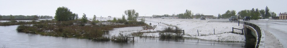
| west-central Platte county to west-central Goshen county | 3-Jun-1995 | Heavy rain occurred from west-central Platte county to west-central Goshen county during the evening hours. Two to three inches of rain fell in west-central Platte county in two hours and this produced flash flooding along the North Laramie River in west-central Platte county about 30 miles west of Wheatland. Flooding was also reported along Cottonwood Creek about 27 miles northwest of Wheatland. Heavy rain fell in Wheatland causing flooding of city streets. Water up to three feet deep was reported on a couple of city streets. Heavy rain at Guernsey (19 miles northeast of Wheatland) caused flash flooding and a few roads were under water as a result. Even some evacuations were necessary in low-lying areas. A rain gauge site located west of Yoder on the Platte/Goshen county line measured five inches of rain during the evening. Reports from this area the next morning (June 4th) revealed nearly 5,000 acres of grassland was under water and hail drifts were still 18 inches deep. |
| Orin Junction to Glendo | 25-Aug-1995 | Heavy rainfall from thunderstorms produced flash flooding between Orin Junction and Glendo. Two miles north of Glendo, water was over Interstate-25 to a depth of a foot. In addition, the water over the Interstate caused two accidents. |
| 15 SW Wheatland | 29-Jul-1996 | Heavy rainfall caused flooding, 15 miles southwest of Wheatland. Dead Horse Creek went out of its banks in that area and washed out a bridge. |
| Wheatland | 14-Sep-1996 | Heavy rainfall from thunderstorms, washed out Iron Mountain Road, which is southwest of Chugwater. Two feet of water was flowing over the road. |
| 10 SW Chugwater | 14-Sep-1996 | South Creek and Polk Creek rose to 5 feet above normal near Wheatland. The high water levels flooded a yard in Wheatland. |
| Guernsey | 19-Jul-1997 | Time approximate; road washed out near Platte River. |