|
Niobrara County Historical Floods
| DAMAGING FLOODS |
| Location | Start Date | Information |
|---|
| South of Lusk | 11-Jun-1960 | The rain caused flooding with some damage to buildings and roads. Some poultry and small livestock were killed by hail. |
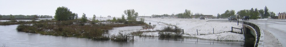
| Niobrara | 7-May-1995 | Moderate to heavy rain fell in these counties during the evening hours. Rainfall between one and one-half and three inches occurred in these areas on top of already saturated soils. This produced flooding of creeks and streams in the three counties. In Niobrara county, three bridges were washed out on county roads. Some flooding of farmland was also reported. |
| Niobrara and Goshen | 15-Jun-1962 | Considerable small hail and heavy thundershowers caused flash flooding. |
| Niobrara and Weston | 21-Jul-1973 | Torrential rains accompanied by hail caused flash flooding in the area creek and river, making roads impassable in spots and damaging bridges. Several earthen dams went out. Although hail size was not specified, banks of hail 3 to 4 feet high were observed along roads and creeks. Crop and property damage was substantial. |
| Central and North portions of Wyoming | 15-May-1978 | Heavy wet snow and record rains did very extensive damage to property, crops, and livestock in 12 counties. Hundreds of homes were damaged, and many totally destroyed. Numerous bridges and sections of roads were washed out, power lines downed, with much damage to cars and personal property. Total estimated damages came to $15.5 million. The following are discharge amounts from WEMA Storm Data: Fifteenmile Creek near Worland (May 18) - 4,270 CFS, Big Horn River at Worland (May 19) - 17,500 CFS, Nowood River near Ten Sleep (May 19) - 3,380 CFS, Shoshone River near Lovell (May 18) - 7,680 CFS), Elk Creek near Basin (May 19) - 2,450 CFS, Shell Creek near Greybull (May 19) - 2,150 CFS, Big Horn River near Kane (May 20) - 20,700 CFS, Little Powder River below Corral Creek near Weston (May 18) - 2,410 CFS, Little Powder River above Dry Creek near Weston (May 19) - 4,460 CFS, Little Powder River above Dry Creek near Weston (May 19) - 5,300 CFS, Salt Creek near Sussex (May 18) - 10,200 CFS, Dead Horse Creek near Buffalo (May 18) - 1,420 CFS, Clear Creek below Rock Creek 162? CFS, Powder River near Kaycee (May 18) - 4,200 CFS, Powder River at Sussex (May 19) - 24,000 CFS, South Fork River near Kaycee (May 20) - 8,200 CFS, Bitter Creek near Garland (May 17) - 552 CFS, Whistle Creek near Garland (May 18) - 2,340 CFS, Shoshone River below Buffalo Bill Reservoir (May 19) - 1,230 CFS, Shoshone River near Garland (May 19) - 4,550 CFS, Goose Creek below Sheridan (May 18) - 5,430 CFS, Prairie Dog Creek near Acme (May 19) - 3,940 CFS, Clear Creek at Ucross 1740 (May 19) - 32,500 CFS, Crazy Woman Creek at Upper Station (May 20) - 2,200 CFS, Little Thunder Creek near Hampshire (May 18) - 3,030 CFS, Black Thunder Creek near Hampshire (May 18) - 5,050 CFS, Turner Creek near Osage (May 18) - 2,480 CFS, Beaver Creek near Newcastle (May 19) - 3,870 CFS. The event was estimated to be a 20- to greater than 100-year flood |
|