|
Johnson County Historical Floods
| DAMAGING FLOODS |
| Location | Start Date | Information |
|---|
| Buffalo, Clear Creek | 11-Jun-1912 | According to WEMA Flood Damage Inventory heavy rain coupled with heavy snowmelt runoff caused flooding. And according to Wyoming Floods and Droughts, National Weather Summary 1988-89 locally intense thunderstorms and snowmelt probably combined with rainfall caused flooding. The flooding according to WEMA Flood Damage Inventory resulted in a building washed down river and it hit a main street bridge, where then the water backed up and out onto the street and the bridge collapsed. According to Wyoming Floods and Droughts, National Weather Summary 1988-1989 the event was a greater than 100-year flood. |
| Buffalo, Powder River | 26-Sep-1923 | A flood noted as the greatest in Powder River history was caused by a cloudburst dumping rain resulting a 20 to 30-foot high wall of water, inundating farms and ranches. The estimated damage was at $100,000 and a loss of 4,500 sheep. Eighteen people were killed when a train crashed due to a weak bridge at Cole Creek south of Casper. |
| Buffalo, Rock Creek | 25-Jun-1955 | Cloudburst created flooding with a wall of water 14 feet high resulting in damaged ranches and sheep lost. |
| Sussex, Powder River | 22-May-1962 | Heavy rains in the Sussex area falling on already wet lands caused flash flooding with livestock, hay and personal property losses. |
| Kaycee | 13-Jul-1962 | Heavy rains west of Kaycee caused flash flooding along the Middle Fork Powder River through Kaycee and vicinity. |
| Buffalo, Clear Creek | 15-Jun-1963 | A 250-year flood caused bridges, canal head gates, and siphons to be washed out. Clear Creek near Buffalo had a discharge of 3,420 CFS and North Piney Creek near Story had a discharge of 1,820 CFS. |
| Buffalo 15 SE, Crazy Woman Creek | 27-Jul-1965 | Rains of 2 to 3 inches with some 1-inch hail did damage to crops and irrigation structures, caused flooding along Crazy Woman Creek |
| Kaycee | 16-Jun-1972 | A heavy thunderstorm with hail to 1.25 inch falling to a depth of 5 inches caused damage to houses, cars, trees and gardens and damage from flash flooding. Storm was 4 to 5 miles wide, lasted 45 minutes, reported heavier east of town. |
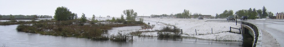
| Central and North portions of Wyoming | 15-May-1978 | Heavy wet snow and record rains did very extensive damage to property, crops, and livestock in 12 counties. Hundreds of homes were damaged, and many totally destroyed. Numerous bridges and sections of roads were washed out, power lines downed, with much damage to cars and personal property. Total estimated damages came to $15.5 million. The following are discharge amounts from WEMA Storm Data: Fifteenmile Creek near Worland (May 18) - 4,270 CFS, Big Horn River at Worland (May 19) - 17,500 CFS, Nowood River near Ten Sleep (May 19) - 3,380 CFS, Shoshone River near Lovell (May 18) - 7,680 CFS), Elk Creek near Basin (May 19) - 2,450 CFS, Shell Creek near Greybull (May 19) - 2,150 CFS, Big Horn River near Kane (May 20) - 20,700 CFS, Little Powder River below Corral Creek near Weston (May 18) - 2,410 CFS, Little Powder River above Dry Creek near Weston (May 19) - 4,460 CFS, Little Powder River above Dry Creek near Weston (May 19) - 5,300 CFS, Salt Creek near Sussex (May 18) - 10,200 CFS, Dead Horse Creek near Buffalo (May 18) - 1,420 CFS, Clear Creek below Rock Creek 162? CFS, Powder River near Kaycee (May 18) - 4,200 CFS, Powder River at Sussex (May 19) - 24,000 CFS, South Fork River near Kaycee (May 20) - 8,200 CFS, Bitter Creek near Garland (May 17) - 552 CFS, Whistle Creek near Garland (May 18) - 2,340 CFS, Shoshone River below Buffalo Bill Reservoir (May 19) - 1,230 CFS, Shoshone River near Garland (May 19) - 4,550 CFS, Goose Creek below Sheridan (May 18) - 5,430 CFS, Prairie Dog Creek near Acme (May 19) - 3,940 CFS, Clear Creek at Ucross 1740 (May 19) - 32,500 CFS, Crazy Woman Creek at Upper Station (May 20) - 2,200 CFS, Little Thunder Creek near Hampshire (May 18) - 3,030 CFS, Black Thunder Creek near Hampshire (May 18) - 5,050 CFS, Turner Creek near Osage (May 18) - 2,480 CFS, Beaver Creek near Newcastle (May 19) - 3,870 CFS. The event was estimated to be a 20- to greater than 100-year flood |
| Buffalo | 29-Jul-1984 | Late afternoon thunderstorm caused flash flooding of many of main streets in Buffalo. Up to 100 homes were affected. Several businesses and a hotel were damaged. A boy was swept into culvert and injured slightly before being pulled to safety. |
| Buffalo Area | 12-Jun-1988 | During the evening of the 12th and intense thunderstorm produced very heavy rainfall and some small hail in a short period of time west of the Town of Buffalo. The rapidly rising waters of Clear Creek forced a road closure in the area. Also, a local rancher east of Buffalo lost a few animals and a cattle guard due to flood conditions. A private bridge was also washed out. |
| Medicine Wheel, Lodgepole Creek, Buffalo | 23-Jul-1989 | From the late afternoon through early evening, slow-moving thunderstorms producing mostly heavy rain occurred across northern Wyoming. From 1245 MST to 1315 MST, even though only 0.33 inch of rain fell, flash flooding of Lodgepole Creek caused water and mud damage to a ranch at Crandall. At 1320 MST, quarter size hail was observed in Yellowstone National Park. Heavy rain, up to 2.1 inches, resulted in flooding of some roads 5 miles southwest of Buffalo and at the Medicine Wheel historic site between 1600 MST and 1800 MST. Finally, from 1700 MST to 1800 MST, 1 foot of "slushy" hail up to marble size covered a few of the roads at the Medicine Wheel landmark. |
| Johnson | 21-Jun-1992 | Up to 5.5 inches of rain in and around the town of Buffalo caused some brief flooding of streets and basements. The town of Buffalo recorded 3.72 inches of rain in a 24-hour period. |
| Kaycee | 7-Jul-1994 | Early on the morning of the 7th, 4 to 5 inches of rain fell southwest of Kaycee causing flash flooding on the Middle Fork of the Power River. Several ranches sustained damage to irrigation equipment and fences. Only minor structural damage was reported from Kaycee. |
| Barnum | 8-Jun-1997 | Extensive flash flooding in the southwestern part of Johnson County in the Barnum and Red Wall areas. Beaver Creek. Roads, bridges, culverts, damaged. Damage estimates unavailable. Times estimated. |
| Buffalo | 8-Jun-1997 | Flash flooding in northern Johnson County in the Buffalo area. Clear Creek and Rock Creek. KOA campground damaged. No damage estimates. Times estimated. |
| Southwest Portion | 30-Jul-1998 | Mayoworth area. Roads washed out. Also Willow Creek area. |
| 10 N Kaycee | 10-Jul-2001 | Flooding around home-basement full of water. Total rainfall estimated at 6.5 inches since around 1500 MST. Sheriff's deputy reported 6 inches of water on Reno Road approximately 10 miles north of Kaycee. Property damage amounts estimated. |
| 12 N Kaycee | 10-Jul-2001 | Flooding around home-basement full of water. Total rainfall estimated at 6.5 inches since around 1500 MST. Sheriff's deputy reported 6 inches of water on Reno Road approximately 10 miles north of Kaycee. Property damage amounts estimated. |
| 10 SE Buffalo | 21-Aug-2002 | The water was reported 6 feet deep along Trabing Road. Also, estimates of 3.5 inches of rain in this area. |
| South Portion | 26-Aug-2002 | A stationary thunderstorm brought flash flooding and Doppler radar rainfall estimates of 7 to 7.5 inches, along Murphy Creek in southern Johnson County. Also, rain gage measurements in excess of 4 inches were reported in this area. Most of the rain fell between midnight and 4 a.m. MDT. A damage survey conducted by the National Weather Service Riverton office determined that Murphy Creek was at one point 300 yards wide and 20 feet deep near Lone Bear Road. This creek eventually comprised the safety of the northbound Interstate 25 bridge over Murphy Creek. |
| Kaycee | 26-Aug-2002 | A stationary thunderstorm brought flash flooding and an estimated 3 inches of rain to Kaycee. Most of the rain fell between midnight and 4 a.m. MDT. The flooding did damage to 19 trailers and 22 houses. In addition,12 businesses, the post office, the conservation district office and telephone company were damaged. The force of the water along the Middle Fork of the Powder River resulted in a hotel being broken into three pieces, with one piece carried 75 yards, and two pieces deposited a few hundred yards away on the opposite side of the Middle Fork of the Powder River. By 0712 MST, the Middle Fork of the Powder River was out of its banks and 4 feet of water was reported on Main Street. Total damage from the flash flood was $459,166. |
| 10 S Buffalo | 19-Jun-2003 | Water reported flowing over Tisdale Road, 10 miles south of Buffalo. Flood waters washed out a portion of Trabing Road, 6 miles south of Buffalo. Two motorcyclists clung to a fence 6 miles east of Buffalo, as their motorcycles were washed away. Neither were injured. |
| NON-DAMAGING FLOODS |
| Southwest Portion | 30-Jul-1998 | Mayoworth area. Roads washed out. Also Willow Creek area. |
| 16 S Kaycee | 17-May-2000 | Flooding on Willow Creek. 2.25 inches of rain past 24 hours. |
| 5 SW Kaycee | 17-May-2000 | Middle Fork of Powder River. Flooding of farmland and near outbuildings. |
| Kaycee | 17-May-2000 | Up to 2.5 inches of rain in 24 hours. Middle Fork of Powder River out of its banks at I-25 just west of Kaycee. |
|