|
Campbell County Historical Floods
| DAMAGING FLOODS |
| Location | Start Date | Information |
|---|
| Gillette 8s | 30-Jul-1987 | A very strong thunderstorm developed near Savageton, about 40 miles southwest of Gillette, at 2045 MST. This storm drenched the town with 1.5 inches of rain in 35 minutes along with 1.5 inch diameter hail. The storm later moved northeast during the next few hours and damaged structures in the south and east sections of Gillette. As the thunderstorm moved into Gillette, 50 to 60 mile an hour winds raked the area along with 1.5 inches of rain in 1 hour. This storm destroyed one unoccupied home. Other damages included numerous horse stalls destroyed, sections of roofs partially destroyed and many city and state road signs severely damaged. Also, lightning struck a home in Gillette and knocked a hole in the ceiling. Many streets and a few apartments were flooded due to the torrential rains between 2100 and 2200 MST. Later that night the very strong thunderstorm moved into Crook County with heavy rain and 0.5 inch diameter hail west of Moorcroft. |
| Gillette | 22-Jul-1966 | A tornado accompanied by heavy rain and hail did damage, caused flash flooding primarily in south and east Gillette. |
| Gillette | 21-Jul-1973 | Heavy rain amounting to about 1.5 inches in one hour resulted in flooded streets and basements and damage to new construction. |
| Wright | 16-May-1987 | A severe thunderstorm downpour dropped over 2.5 inches of rain over the town of Wright in 45 minutes. About 14 homes sustained minor damage and 3 homes had major damage. The 3 homes with major damage had approximately 3 to 14 inches of water in their basements. Two culverts near the damaged homes could not convey the amount of water that occurred in backwater flooding. |
| Savageton | 30-Jul-1987 | A very strong thunderstorm developed near Savageton, about 40 miles southwest of Gillette, at 2045 MST. This storm at Savageton drenched the town with 1.5 inches of rain in 35 minutes along with one and a half inch diameter hail. The storm later moved northeast during the next few hours and damaged structures in the south and east sections of Gillette. As the thunderstorm moved into Gillette, 50 to 60 mile an hour winds raked the area along with 1.5 inches of rain in one hour. This storm destroyed 1 unoccupied home. Other damages included numerous horse stalls destroyed, sections of roofs partially destroyed and many city and state road signs severely damaged. Also, lightning struck a home in Gillette and knocked a hole in the ceiling. Many streets and a few apartments were flooded due to the torrential rains between 2100 and 2200 MST. Later that night the very strong thunderstorm moved into Crook County with heavy rain and one-half inch diameter hail west of Moorcroft. |
| 8 N Rozet | 19-Aug-1993 | A person working on an oil rig died when he was caught in a flash flood in what usually is a dry creek bed. |
| Weston | 22-Jun-1998 | General flooding was reported near Weston with stock ponds overflowing and roads being threatened. |
| 26 W Wright | 1-Jul-1998 | Heavy rains of six inches in an hour caused a stock dam to breach on the Iberland Ranch, and caused flooding along highway #387. |
| 18 SSW Gillette | 2-Jul-1998 | Flood waters covered highway 50 between mile markers 16 and 20. |
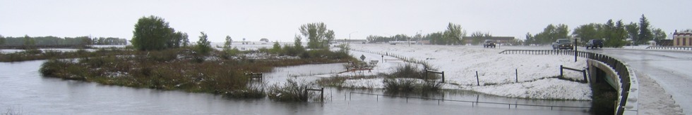
| 4 S Gillette to Gillette, Donkey Creek | 28-May-2001 | Heavy rain began falling over the Donkey Creek drainage, just south of Gillette, around 1700 MST. Rainfall rates over 2 inches per hour were recorded. A National Weather Service spotter recorded a storm total precipitation amount of 7.5 inches during the evening. Donkey Creek quickly rose to flood stage, tearing up paved golf cart paths and a service bridge located at the Gillette Country Club. Water depth was recorded at 4 feet by a water mark on a stop sign at Four J Road near Southern Drive at 1900 MST. In downtown Gillette, several cars were reported floating down the street, and numerous businesses had 1 to 2 feet of water on the first floor. There were no injuries or fatalities, however one man was rescued from a stalled vehicle in chest deep water. |
| Central and North portions of Wyoming | 15-May-1978 | Heavy wet snow and record rains did very extensive damage to property, crops, and livestock in 12 counties. Hundreds of homes were damaged, and many totally destroyed. Numerous bridges and sections of roads were washed out, power lines downed, with much damage to cars and personal property. Total estimated damages came to $15.5 million. The following are discharge amounts from WEMA Storm Data: Fifteenmile Creek near Worland (May 18) - 4,270 CFS, Big Horn River at Worland (May 19) - 17,500 CFS, Nowood River near Ten Sleep (May 19) - 3,380 CFS, Shoshone River near Lovell (May 18) - 7,680 CFS), Elk Creek near Basin (May 19) - 2,450 CFS, Shell Creek near Greybull (May 19) - 2,150 CFS, Big Horn River near Kane (May 20) - 20,700 CFS, Little Powder River below Corral Creek near Weston (May 18) - 2,410 CFS, Little Powder River above Dry Creek near Weston (May 19) - 4,460 CFS, Little Powder River above Dry Creek near Weston (May 19) - 5,300 CFS, Salt Creek near Sussex (May 18) - 10,200 CFS, Dead Horse Creek near Buffalo (May 18) - 1,420 CFS, Clear Creek below Rock Creek 162? CFS, Powder River near Kaycee (May 18) - 4,200 CFS, Powder River at Sussex (May 19) - 24,000 CFS, South Fork River near Kaycee (May 20) - 8,200 CFS, Bitter Creek near Garland (May 17) - 552 CFS, Whistle Creek near Garland (May 18) - 2,340 CFS, Shoshone River below Buffalo Bill Reservoir (May 19) - 1,230 CFS, Shoshone River near Garland (May 19) - 4,550 CFS, Goose Creek below Sheridan (May 18) - 5,430 CFS, Prairie Dog Creek near Acme (May 19) - 3,940 CFS, Clear Creek at Ucross 1740 (May 19) - 32,500 CFS, Crazy Woman Creek at Upper Station (May 20) - 2,200 CFS, Little Thunder Creek near Hampshire (May 18) - 3,030 CFS, Black Thunder Creek near Hampshire (May 18) - 5,050 CFS, Turner Creek near Osage (May 18) - 2,480 CFS, Beaver Creek near Newcastle (May 19) - 3,870 CFS. The event was estimated to be a 20- to greater than 100-year flood |
| Gillette | 24-Jul-1982 | Brief heavy rains (about one inch) from a thunderstorm caused minor urban flooding. High winds associated with the storm did some minor damage northeast of Gillette. |
| Gillette | 25-Jul-1982 | A thunderstorm produced more than an inch of rain on Gillette in less than 20 min. The storm also brought marble-size hail and winds up to 50 mph. The Gillette area was already saturated from storms of the preceding Wednesday and Saturday. Storm related damages primarily due to flooding approached one million dollars. |
| NON-DAMAGING FLOODS |
| Recluse to Weston | 1997-07-18 | Low land flooding was reported along Horse Creek and Little Powder River. |
| Northern Campbell | 2005-06-24 | Heavy rains north of Rozet resulted in the flooding of Cow Creek Road, about 10 miles north of Rozet, for a short period of time. |
|